Land For Sale £120,000
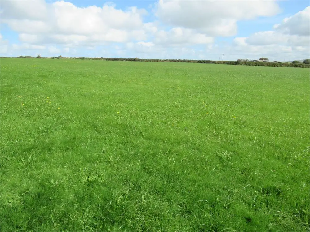
Situated within a few miles of the hamlet of Castlemorris and the village of Hayscastle, a gently sloping block of Accommodation Land which extends to 17.10 Acre or thereabouts which is virtually all down to permanent Pasture with the exception of the Lane on the northern boundary which is overgrown. The Land is Sheep fenced and in good condition and is approached over a 200 yard track off the Council Maintained District Road. Blocks of Accommodation Land of this nature are few and far between and early inspection is strongly advised. Realistic Price Guide.
Situation
The land concerned is situated within 2 miles or so of the hamlet of Castlemorris and is within 2 ½ miles or so of the well known village of Hayscastle.
Hayscastle is a small village and is situated within a mile or so of the other well known village of Hayscastle Cross, which has the benefit of a Public House.
Castlemorris is within a short drive and has the benefit of a Public House and within 3 ½ miles or so is the popular hilltop village of Mathry. Mathry has the benefit of a Church, Village Hall, former Chapel, Café/Antique Shop and a Public House.
The Market Town of Fishguard is some 8 miles or so North East and has the benefit of a good Shopping Centre together with a wide range of amenities and facilitates.
The County and Market Town of Haverfordwest is some 12 miles or so South East and has an excellent Shopping Centre with an extensive range of amenities and facilities including The County Council Offices and The County Hospital at Withybush. There are good road links in an easterly direction along the Main A40 from Haverfordwest to Carmarthen and M4 Motorway to Cardiff and London. There are also good rail links from both Fishguard and Haverfordwest to Carmarthen, Cardiff, London Paddington and the rest of the UK.
The Land concerned is formerly part of Priskilly Fawr and is approximately three quarters of a mile or so off the Castlemorris to Hayscastle Council Maintained District Road.
Description
The land concerned extends to some 17.10 Acres or thereabouts and is all down to Permanent Pasture and being gently sloping with a southerly aspect. The Land is sheep fenced and in good condition and is approached off the Council Maintained District Road via a 200 yard hardsurfaced track. The boundaries of the Property are indicated on the attached Plan which is not to scale.
Services
There are no Services connected to the Land. Mains Water is available in the vicinity of Priskilly Fawr, but not connected to the property.
Tenure
Freehold with Vacant Possession upon Completion.
Land Registry
O.S. No 1231 and amounting to 16.26 Acres is a Registered Title, although Pt os No 9552 and Pt Os No 6150 are not registered to the vendors. The vendors have been utilising this Land for a considerable period of time and will convey to the purchaser whatever interest that they have in the Land. The unregistered Land extends to 0.84 Acres or thereabouts.
Rights Of Way
Agricultural access Rights of Ways exist in favour of the Land off the Council Maintained District Road leading to Priskilly Fawr at point ‘A’ on the Plan and over the Track/Lane as far as point B on the same Plan. The Track/Lane between points ‘A’, ‘B’ and ‘C’ on the Plan is registered as a Public Footpath.
General Remarks
The Land concerned extends to 17.10 Acres or thereabouts and of the total Acerage there is 16 Acres or thereabouts of clean, gently sloping Pasture Land in excellent heart. The Land is sheep fenced and is situated within a few hundred yards of the Council Maintained roadway leading to Priskilly Fawr. Blocks of Accommodation Land of this nature are few and far between and early inspection is strongly advised.
Directions
From Fishguard take the Main A40 Road south for some 2 miles and just prior to entering the village of Scleddau take the turning on the right signposted to St David’s and Jordanston. Continue on this road for some 300 yards or so and where the road sweeps right, bear left (straight on) signposted to St David’s and Jordanston. Continue on this road for a mile and a half or so and upon reaching the crossroads at Llangloffan Cross (the second set of crossroads), turn left. Proceed on this road through the hamlet of Llangloffan and continue over the bridge and follow the road until you reach the hamlet of Castlemorris. At the crossroads, proceed straight across and continue on this road for half a mile or so, passing through Penfeidr and a half a mile or so further on and upon reaching the crossroads, proceed straight on. Continue on this road for half a mile or so and take the first turning on the left. Proceed on this road in excess of half a mile and the track leading to the land is situated on the left hand side of the road. A ‘For Sale’ direction board is placed at this point. A 200 yard track leads into the property.