Land For Sale £270,000
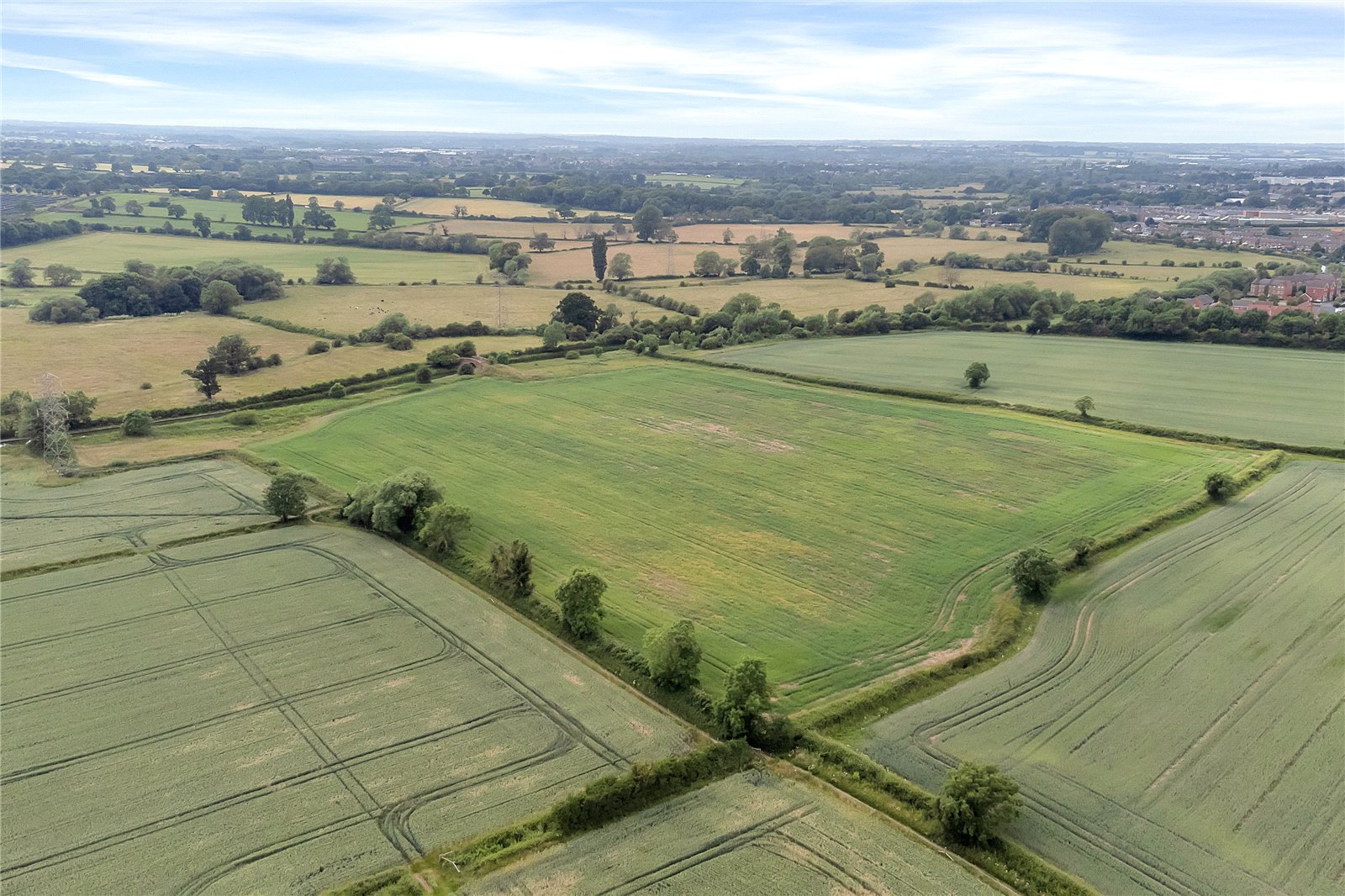
The land comprises about 20.68 acres (8.37 ha) of permanent
pasture and about 28.14 acres (11.39 ha) of productive arable
land.<br/></br>
<b>Situation</b>
The land is situated on the edge of Wigston, approximately 5 miles from Leicester city centre.
</br>
<b>Description</b>
The land comprises about 20.68 acres (8.37 ha) of permanent pasture and about 28.14 acres (11.39 ha) of productive arable land.
</br>
Please note: The land is accessed via a bridge over the mainline railway to the south of Wigston.
</br>
<b>Permanent Pasture</b>
The permanent pasture is located to the south of the canal, lying relatively flat. The land is bordered by mature hedgerows and stock proof fencing in part. The land has been primarily used for grazing livestock but may be suitable for mowing in parts or other uses, such as woodland planting, subject to the necessary consents. The land is subject to seasonal flooding and interested parties must make their own enquiries in respect of flood risk. The permanent pasture is accessed via a canal bridge from the arable land and interested parties should ensure the bridge is suitable for their intended future use.
</br>
<b>Arable Land</b>
The arable land comprises 28.14 acres of level, base-rich loamy soils, previously cropped with Barley and Wheat. The arable land is split into three field parcels with access provided via a right of way for agricultural vehicles off Britford Avenue, over the railway line.
</br>
<b>Land Quality and Soil Type</b>
The land is classified as Grade 3 according to the Natural England Regional Agricultural Land Classification Maps. The soils may be described as slowly permeable seasonally wet slightly acidic but base-rich loamy and clayey soils. The land to the South of the canal is generally suited to grass production/ livestock grazing, with the arable land across the canal suited to traditional crop rotation.
</br>
<b>Basic Payment Scheme and Environmental Schemes</b>
The property is registered with the Rural Payments Agency for the basic payment scheme. Payments for the current scheme year will be retained by the outgoing tenant. The purchaser(s) will be required to indemnify against any loss due to a breach of cross compliance up to the end of the current scheme year.
</br>
Entitlements are not included within the sale but may be available by separate negotiation.
</br>
Part of the land is subject to a mid-tier countryside stewardship scheme. Further details are available from the selling agent.
</br>
<b>VAT</b>
Any guide price quoted or discussed is exclusive of VAT. In the event that a sale of the property or any part thereof or any right to it becomes a chargeable supply for the purposes of VAT, such tax will be payable in addition to the sale price.
</br>
<b>Sporting, Mineral and Timber Rights</b>
The sporting, mineral and timber rights will be transferred with the freehold title where owned.
</br>
<b>Nitrate Vulnerable Zone (nvz)</b>
The Property lies within a Surface Water nvz Area and is subject to the usual restrictions.
</br>
<b>Overage</b>
The land will be sold subject to an uplift provision which will specify that 30% of any increase in value due to development (as defined in Section 55 of the Town and Country Planning Act 1990) will be payable to the Vendors or their successors in title should such development occur within 25 years from the date of completion. The uplift will be payable upon implementation or on a future sale with the benefit of a planning consent but shall not be triggered by any development for agricultural and/or equestrian purposes.
</br>
<b>Tenure and Possession</b>
The freehold of the property is to be sold subject to a periodic farm business tenancy.
</br>
Further details are available from the selling agents.
</br>
The land is offered for sale by private treaty and is available as a whole.
</br>
<b>Plans, Schedules and Boundaries</b>
The plans and schedules within these particulars are based on Ordnance Survey data and are provided for reference only. These plans are believed to be correct but accuracy is not guaranteed. Purchasers shall be deemed to have full knowledge of all boundaries and the extent of ownership. Neither the vendors nor the vendor's agents will be responsible for defining the boundaries or the ownership thereof.
</br>
<b>Public Rights of Way, Wayleaves and Easements</b>
The property is sold subject to all rights of way, wayleaves and easements whether or not they are defined in this brochure.
</br>
<b>Services</b>
Potential purchasers are to make their own enquiries in respect of the provision of any services with the service providers regarding the potential to gain connections, if required. None of the services, appliances or electrical systems have been tested by the selling agents.
</br>
<b>Local Authority</b>
Leicestershire County Council.
</br>
<b>Viewings</b>
Viewings of the land may be undertaken during daylight hours only and with a copy of these particulars to hand. Viewers must confirm the time of their inspection to the selling agent prior to arrival. Please note the property is a working farm and viewers must take precautions with livestock and potential farm machinery on the property.
</br>
Please Note: Access is not available from Britford Avenue on foot or by motor vehicle for interested parties. Parties should access the land via the footbridge over the railway from Barford Close and follow the footpath heading south towards the canal.
</br>
<b>Directions</b>
What3words:
Britford Avenue Access ///boats.fine.shops
Arable Land: ///mops.drank.drips
Pasture Land: ///inspector.ideal.soak
Closest postcode: LE18 2RA
From the A6 North Bound, exit Archers Roundabout at the second exit onto Station Road. After 0.2 miles, turn right onto Newton Lane and continue for 1 mile to Newton Lane. Continue onto Glen Road for 1 mile and then turn right onto Newton Lane again. Follow Newton Lane for 0.3 miles and take the first exit at the roundabout onto Bushloe End. Follow Bushloe End for 0.5 miles and take the first exit at the roundabout onto Launceston Road. Follow Launceston Road for 0.8 miles, turn right onto Durnford Road and the footbridge to access the land is located at the end of Barford Close.
