Land For Sale £150,000
Lot 1 Some 14.32 acres (5.70 hectares) as outlined in red on the site plan. Four further lots also available of productive bare farmland and amenity land for sale as a whole or in up to 5 lots (ranging from 1.36 acres to 58.02 acres), offering potential for alternative uses (subject to planning)
Directions From Kingsbridge proceed in a northerly direction on the A381 towards Totnes. On reaching Torr Quarry Industrial Estate, the land can be found on the left and right hand side of the entrance road leading into Torr Quarry Industrial Estate.
Access can also be gained to the land off the council maintained road leading to Lower Grimpstonleigh from Tor Lane End or off the public byway lane leading from Woodleigh to Lower Grimpstonleigh (see site plan), running along the north boundary of this land.
What3Words: Restores.daydream.paid
situation The land part Higher Torr Farm is situated between the town of Kingsbridge and the hamlet of the Mounts, in the parish of East Allington in South Devon.
The nearest town of Kingsbridge is approximately 2 miles to the south, the town of Totnes approximately 8 miles to the north and the A38 dual carriageway expressway, connecting to the M5 motorway and national road network, approximately 13 miles to the north.
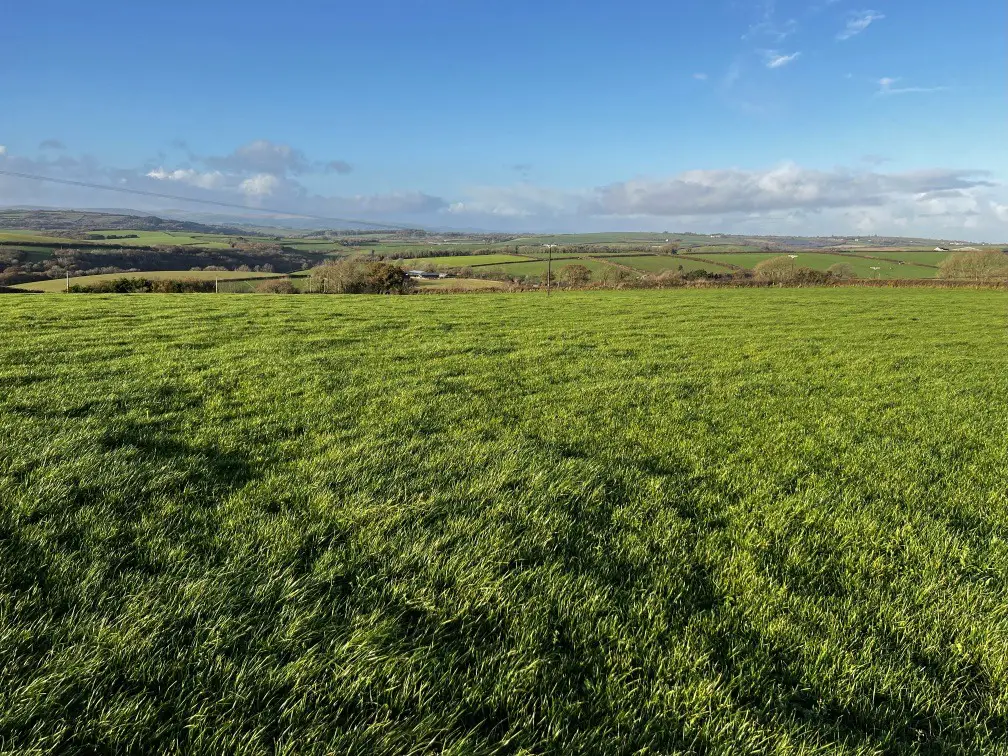
Description The land part Higher Torr Farm extends to a total of some 175.95 acres (71.21 hectares) of bare agricultural and amenity land. It is available for sale as a whole or in up to five lots, as may suit buyer's requirements.
Dealing with each lot in turn and by reference to the site plan:-
lot 1 – 14.32 acres (5.70 hectares) as outlined in red on the site plan With access to this land being gained through a gateway on the western boundary, this land is reasonably level with a gentle north, east and west facing slope to parts.
The land is bounded by mature hedgerows and a council maintained highway on the southwest and southeast boundaries with other agricultural land on the north and northeast boundaries.
Field NumberHectaresAcresDescription
sx .7914.32Temporary grass
TOTAL5.7914.32
The land offers the potential for livestock grazing, arable cropping purposes or for general recreational/equestrian use (subject to gaining the necessary planning consent).
There is no water supply to this land.
Lot 2 – 58.02 acres (23.48 hectares) as outlined in blue on the site plan Access to this block may be gained either off the north or south boundaries with the north boundary running against the council maintained highway and the southern boundary running alongside the entrance road leading to Higher Torr Quarry Industrial Estate.
The east boundary is against the A381 Kingsbridge to Totnes road and the west boundary is against Torr Quarry industrial estate.
With a combination of gentle east, west and south facing slopes, this land offers potential for arable cropping purposes or could continue to be used for livestock grazing/grass conservation purposes.
A metered mains water supply serves this block of land and is connected to a number of water troughs (but see 'Mains Water' paragraph below).
Field NumberHectaresAcresDescription
sx .4713.51Temporary grass
sx .6211.41Temporary grass
sx .5213.63Temporary grass
sx .5918.75Temporary grass
sx .290.72Temporary grass
TOTAL23.4858.02
lot 3 – 56.63 acres (22.92 hectares) as outlined in green on the site plan Access to this land may be gained through a gateway located off the entrance road leading into Torr Quarry and close to the entrance where the entrance to Torr Quarry joins the main A381 Totnes to Kingsbridge road.
A large part of this lot comprises an area of productive agricultural land suitable for arable/continued grazing/mowing purposes, but there is also an area of land which is down to permanent pasture which is suitable for grazing purposes and/or general recreation/amenity purposes (subject to gaining the necessary planning consent).
A metered mains water supply serves this land and is connected to some water troughs (but see 'Mains Water' paragraph below). There is also a spring water supply which runs down through the valley to meet the brook on the north boundary.
Field NumberHectaresAcresDescription
sx .8011.86Temporary grass
sx .546.28Temporary grass
sx .448.50Temporary grass
sx .167.81Permanent Pasture
sx .029.93Permanent Pasture
sx .308.15Temporary grass
sx .664.10Permanent grass
TOTAL22.9256.63
lot 4 – 45.62 acres (18.46 hectares) as outlined in purple on the site plan Access to this land may be gained off the public byway leading from Woodleigh to Grimpstonleigh which runs along the north boundary. A large part of this byway is suitable for tractors and four wheel drive vehicles.
The land is mainly down to permanent grass save for some areas which have been used as game cover for shooting purposes (see tenure below) and one field has been used for arable cropping purposes.
The land comprises a combination of gentle, moderate and in places steep north, east and west facing slopes.
A spring water supply runs along the east boundary of field 6671.
Field NumberHectaresAcresDescription
sx .624.00Permanent Pasture
sx .0817.49Permanent Pasture
sx .308.15Stubble
sx .353.33Permanent Pasture
sx .5511.24Permanent Pasture
sx .571.41Permanent Pasture
TOTAL18.4645.62
lot 5 – 1.36 acres (0.55 hectares) as outlined in yellow on the site plan An area of amenity woodland which is bordered by the public byway on the south boundary and a stream/brook on the north boundary.
An area of land suitable for continued conservation/wildlife purposes or for general/recreational (subject to planning) as may suit buyer's requirements.
Field NumberHectaresAcres Description
sx .551.36Amenity woodland
TOTAL0.551.36
tenure The land is being sold on a freehold basis subject to the leases, licences and agreements outlined below. Further details are available from the vendor's agent.
1. Farm Business Tenancy Agreement in relation to Lots 1,2 and part of Lot 3 (field numbers 4789,3880,0993 and 2108) with a rent payable of £11,100 per annum and the agreement due to expire 29 September 2024.
2. A Farm Business Agreement in relation to the remainder of Lot 3 and Lot 4 with a rent payable of £2,500 per annum and the agreement due to expire (subject to the appropriate notices being issued) on 31 March 2025.
3. A shooting Lease over the entirety of the land at a nominal rent of £1, which is due to expire on 16 November 2028.
Mains water supply There is currently a metered mains water supply which serves Lots 2 and 3, but in the event there are separate buyers for each of these lots then this water supply will be disconnected to Lot 3, such that the existing meter will only then serve Lot 2.
The buyer of Lot 3 will be required to make their own arrangements to gain a mains water supply to this lot.
Basic payment scheme The land is registered for the purpose of the Basic Payment Scheme (bps), however there are no Basic Payment Scheme entitlements included with the sale of the land.
Sporting and mineral rights All sporting and mineral rights are included with the land as far as are known (albeit there is a shooting lease in place as referred to above).
Environmental grant schemes The land is not subject to any Environmental Grant schemes.
Method of sale The land is being offered for sale by Private Treaty as a whole or in a combination of lots as may suit buyer's requirements.
Depending on the level of interest received the sellers and their agents reserve the right to seek best offers for the land by a deadline date.
The sellers reserve the right not to accept any offer or the highest offer for any of the lots.
The sellers invite buyers to submit offers for any areas of the land that they may be interested in should it be a different area to the way in which the land has been lotted.
Overage Field numbers 7024,7195,2108,3880 and 4789 are being sold subject to an overage restriction in respect of any future residential or commercial development such that should the new owner (s) be successful in obtaining planning consent for change of use of this land to residential or commercial use they will be required to pay the sellers (or their successors in title) an uplift of 25% of the value and this to apply for 25 years from legal completion.
This overage payment to be made to the seller or their successors entitled to the payment on the granting of the planning consent for change of use.
Guide prices Lot 1 - £150,000
Lot 2 - £550,000
Lot 3 - £450,000
Lot 4 - £300,000
Lot 5 - £10,000
Whole - £1,460,000
Viewing Strictly by appointment with the Sole Selling Agents, Luscombe Maye of 62 Fore Street, Kingsbridge, TQ7 1PP. Telephone or for further details.
These viewing arrangements are to be strictly adhered to as a shoot is conducted over the land and to therefore ensure the safety of all those wishing to view the land.
Directions From Kingsbridge proceed in a northerly direction on the A381 towards Totnes. On reaching Torr Quarry Industrial Estate, the land can be found on the left and right hand side of the entrance road leading into Torr Quarry Industrial Estate.
Access can also be gained to the land off the council maintained road leading to Lower Grimpstonleigh from Tor Lane End or off the public byway lane leading from Woodleigh to Lower Grimpstonleigh (see site plan), running along the north boundary of this land.
What3Words: Restores.daydream.paid
situation The land part Higher Torr Farm is situated between the town of Kingsbridge and the hamlet of the Mounts, in the parish of East Allington in South Devon.
The nearest town of Kingsbridge is approximately 2 miles to the south, the town of Totnes approximately 8 miles to the north and the A38 dual carriageway expressway, connecting to the M5 motorway and national road network, approximately 13 miles to the north.
Description The land part Higher Torr Farm extends to a total of some 175.95 acres (71.21 hectares) of bare agricultural and amenity land. It is available for sale as a whole or in up to five lots, as may suit buyer's requirements.
Dealing with each lot in turn and by reference to the site plan:-
lot 1 – 14.32 acres (5.70 hectares) as outlined in red on the site plan With access to this land being gained through a gateway on the western boundary, this land is reasonably level with a gentle north, east and west facing slope to parts.
The land is bounded by mature hedgerows and a council maintained highway on the southwest and southeast boundaries with other agricultural land on the north and northeast boundaries.
Field NumberHectaresAcresDescription
sx .7914.32Temporary grass
TOTAL5.7914.32
The land offers the potential for livestock grazing, arable cropping purposes or for general recreational/equestrian use (subject to gaining the necessary planning consent).
There is no water supply to this land.
Lot 2 – 58.02 acres (23.48 hectares) as outlined in blue on the site plan Access to this block may be gained either off the north or south boundaries with the north boundary running against the council maintained highway and the southern boundary running alongside the entrance road leading to Higher Torr Quarry Industrial Estate.
The east boundary is against the A381 Kingsbridge to Totnes road and the west boundary is against Torr Quarry industrial estate.
With a combination of gentle east, west and south facing slopes, this land offers potential for arable cropping purposes or could continue to be used for livestock grazing/grass conservation purposes.
A metered mains water supply serves this block of land and is connected to a number of water troughs (but see 'Mains Water' paragraph below).
Field NumberHectaresAcresDescription
sx .4713.51Temporary grass
sx .6211.41Temporary grass
sx .5213.63Temporary grass
sx .5918.75Temporary grass
sx .290.72Temporary grass
TOTAL23.4858.02
lot 3 – 56.63 acres (22.92 hectares) as outlined in green on the site plan Access to this land may be gained through a gateway located off the entrance road leading into Torr Quarry and close to the entrance where the entrance to Torr Quarry joins the main A381 Totnes to Kingsbridge road.
A large part of this lot comprises an area of productive agricultural land suitable for arable/continued grazing/mowing purposes, but there is also an area of land which is down to permanent pasture which is suitable for grazing purposes and/or general recreation/amenity purposes (subject to gaining the necessary planning consent).
A metered mains water supply serves this land and is connected to some water troughs (but see 'Mains Water' paragraph below). There is also a spring water supply which runs down through the valley to meet the brook on the north boundary.
Field NumberHectaresAcresDescription
sx .8011.86Temporary grass
sx .546.28Temporary grass
sx .448.50Temporary grass
sx .167.81Permanent Pasture
sx .029.93Permanent Pasture
sx .308.15Temporary grass
sx .664.10Permanent grass
TOTAL22.9256.63
lot 4 – 45.62 acres (18.46 hectares) as outlined in purple on the site plan Access to this land may be gained off the public byway leading from Woodleigh to Grimpstonleigh which runs along the north boundary. A large part of this byway is suitable for tractors and four wheel drive vehicles.
The land is mainly down to permanent grass save for some areas which have been used as game cover for shooting purposes (see tenure below) and one field has been used for arable cropping purposes.
The land comprises a combination of gentle, moderate and in places steep north, east and west facing slopes.
A spring water supply runs along the east boundary of field 6671.
Field NumberHectaresAcresDescription
sx .624.00Permanent Pasture
sx .0817.49Permanent Pasture
sx .308.15Stubble
sx .353.33Permanent Pasture
sx .5511.24Permanent Pasture
sx .571.41Permanent Pasture
TOTAL18.4645.62
lot 5 – 1.36 acres (0.55 hectares) as outlined in yellow on the site plan An area of amenity woodland which is bordered by the public byway on the south boundary and a stream/brook on the north boundary.
An area of land suitable for continued conservation/wildlife purposes or for general/recreational (subject to planning) as may suit buyer's requirements.
Field NumberHectaresAcres Description
sx .551.36Amenity woodland
TOTAL0.551.36
tenure The land is being sold on a freehold basis subject to the leases, licences and agreements outlined below. Further details are available from the vendor's agent.
1. Farm Business Tenancy Agreement in relation to Lots 1,2 and part of Lot 3 (field numbers 4789,3880,0993 and 2108) with a rent payable of £11,100 per annum and the agreement due to expire 29 September 2024.
2. A Farm Business Agreement in relation to the remainder of Lot 3 and Lot 4 with a rent payable of £2,500 per annum and the agreement due to expire (subject to the appropriate notices being issued) on 31 March 2025.
3. A shooting Lease over the entirety of the land at a nominal rent of £1, which is due to expire on 16 November 2028.
Mains water supply There is currently a metered mains water supply which serves Lots 2 and 3, but in the event there are separate buyers for each of these lots then this water supply will be disconnected to Lot 3, such that the existing meter will only then serve Lot 2.
The buyer of Lot 3 will be required to make their own arrangements to gain a mains water supply to this lot.
Basic payment scheme The land is registered for the purpose of the Basic Payment Scheme (bps), however there are no Basic Payment Scheme entitlements included with the sale of the land.
Sporting and mineral rights All sporting and mineral rights are included with the land as far as are known (albeit there is a shooting lease in place as referred to above).
Environmental grant schemes The land is not subject to any Environmental Grant schemes.
Method of sale The land is being offered for sale by Private Treaty as a whole or in a combination of lots as may suit buyer's requirements.
Depending on the level of interest received the sellers and their agents reserve the right to seek best offers for the land by a deadline date.
The sellers reserve the right not to accept any offer or the highest offer for any of the lots.
The sellers invite buyers to submit offers for any areas of the land that they may be interested in should it be a different area to the way in which the land has been lotted.
Overage Field numbers 7024,7195,2108,3880 and 4789 are being sold subject to an overage restriction in respect of any future residential or commercial development such that should the new owner (s) be successful in obtaining planning consent for change of use of this land to residential or commercial use they will be required to pay the sellers (or their successors in title) an uplift of 25% of the value and this to apply for 25 years from legal completion.
This overage payment to be made to the seller or their successors entitled to the payment on the granting of the planning consent for change of use.
Guide prices Lot 1 - £150,000
Lot 2 - £550,000
Lot 3 - £450,000
Lot 4 - £300,000
Lot 5 - £10,000
Whole - £1,460,000
Viewing Strictly by appointment with the Sole Selling Agents, Luscombe Maye of 62 Fore Street, Kingsbridge, TQ7 1PP. Telephone or for further details.
These viewing arrangements are to be strictly adhered to as a shoot is conducted over the land and to therefore ensure the safety of all those wishing to view the land.