Land For Sale £1,340,000
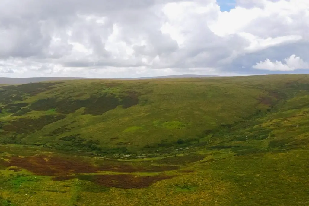
The property boasts extensive open moorland, rugged hillsides & species rich valleys with a huge variety of flora & fauna, with several natural springs and watercourses. There are unrivalled panoramic views across Dartmoor & to the South Devon coast from the high ground which includes the highest point on southern Dartmoor.
There are considered to be extensive natural capital opportunities available now and in future as markets continue to develop for the provision of public goods including nature recovery, flood management, carbon sequestration and personal wellbeing.
The land is subject to public open access and common grazing rights.
Available as a whole or in up to three lots:
Lot 1 – Buckfastleigh Moor; About 722 acres (292 ha); Guide Price: £1,100,000
Lot 2 – Land at Water Oak Corner; About 123 acres (50 ha); Guide Price: £200,000
Lot 3 – Land North of the River Mardle; About 13 acres (5 ha); Guide Price: £40,000
The Whole: About 858 acres (347 ha); Guide Price: £1,340,000
Lot 1 - Buckfastleigh Moor
About 722.57 acres (292.41 ha)
Including most of Buckfastleigh Moor and three high peaks with extensive views across the region including over swathes of Dartmoor and South Devon and to the coast along the Dart Valley. Ryder’s Hill (515m) marks the north western corner of the moor and is the highest point in Southern Dartmoor. It has what is believed to be a prehistoric cairn, a trig point and a pair of boundary marker stones. From here the ridgeline runs south east across peatland bogs towards Snowdon (495m) and along to Pupers Hill (467m) where there are rocky outcrops and cairns and a significant Bronze Age reave. The moor slopes generally down and eastwards from the ridgeline and high peaks, with various historic hut enclosures and reaves across the area.
The River Mardle rises at around 430m above sea level, within a shallow valley along the northern boundary. The river marks the northern boundary of lot 1 as it twists & turns down to Chalk Ford (around 240m above sea level) which is a icturesque river crossing with a small glade and a footbridge (and public bridleway). Chalk Ford is one of the two accesses to Lot 1 and is accessed along a stone track, forming the ancient drift-way from the village of Scoriton, where there is a pub. A second access to Lot 1 is available at Lud Gate (pronounced ‘Lyd Gate’) in the south eastern corner, where the public highway gives way to a stone track and up onto the moor. This access will also be used and shared with the owner of Lot 2 if sold separately. Boundaries on the moor are occasionally marked with historic boundary stones, and otherwise are believed to follow ground features such as old reaves and banks. The moor is
almost entirely unfenced.
Lot 1 is entirely designated as a SSSI and Special Area of Conservation (SAC). On the higher ground the soil is shown as predominantly blanket bog (deep peaty soils), with shallow peaty soils on lower ground. The land is subject to common grazing rights, meaning the grazing is shared.
Lot 2 - Land at Water Oak Corner
About 122.83 acres (49.71 ha)
A large parcel of upland heath and open moor land with extensive views across neighbouring commons and farmland, and down to the coast of South Devon. This land is outside of the SSSI and SAC boundaries, however still within the National Park and subject to common grazing rights and open access.
This land is predominantly shown as Wet Heath, being shallow peaty soils (source: Natural England). The land cover is mostly grassland heath, with granite boulders and interspersed with areas of bracken and occasional scrubland trees. There is an area of prehistoric settlement with two hut circles, a field enclosure and a length of bank.
There are two natural springs/watercourses and the remnants of a leat that once took water across the moor to the copper mines on the Brook Manor Estate.
Access is via a stone track forming the ancient driftway leading to Lud Gate and onto the moor. This access will also be used and shared with the owner of Lot 1 if sold separately. The boundary to the east of Lot 2 is farmland and woodland, bordered by stone walling, earth banks and fencing. To the north, west and south is open access moorland, and the indicative boundary is an old reave along the high ground running roughly north to south with occasional boundary stones.
Lot 3 - Land North of the River Mardle
About 13.04 acres (5.28 ha)
An opportunity to purchase a bite size parcel of the moor, with 13 acres of mixed ground comprising part open heathland suited to grazing and conservation and part steep sided woodland, and access to the River Mardle.
Access to the property is via a public footpath over Scoriton Down (currently a deer park) or over the moor using open access rights. This would be a wonderful property on which to undertake a small scale conservation project and to enjoy the beauty and ownership of a secluded corner of the moor in a special location.
Lot 3 is subject to common grazing rights, but in the current system this area is rarely grazed.
General Matters
Method of sale: The property is offered for sale as a whole or in up to three lots by private treaty. Tenure: The property is sold freehold subject to commoners grazing rights.
Services: No services are connected. There are natural water supplies within each lot.
Outgoings / Rates: None.
Access: Lot 1 is accessed via stone tracks at Lud Gate and at Chalk Ford.
Lot 2 is accessed via the stone track at Lud Gate.
Lot 3 is accessed via a public footpath across Scoriton Down.
Access is otherwise available on foot or on horseback across other areas of the moor. Wayleaves, easements and rights of way: The Dartmoor Commons Act (1985) provides a right of access on foot and horseback for members of the public to common land including this property. In addition, the public has a right of access on foot across the property under the Countryside & Rights of Way Act 2000 (CRoW).
There is a public bridleway between Lud Gate
& Chalk Ford.
The property is being sold subject to and with
the benefit of all rights including; rights of
way, whether public or private, light, support,
drainage, water and electricity supplies and other rights and obligations, easements and
quasi-easements and restrictive covenants and
all existing and proposed wayleaves for masts,
pylons, stays, cables, drains, water and gas
and other pipes whether referred to in these
particulars or not.
Basic Payment: The entitlements to the Basic Payment are not included in the sale.
Plans, Areas & Boundaries: any representation by the owner or agent is indicative only and should not be relied upon without clarification from a legal advisor.
Schemes: The land is entered into a Higher Level Stewardship scheme ending November 2023. The purchaser will be deemed to have full knowledge of the scheme(s) and will take it on and comply with the scheme from completion if necessary. The vendor will retain any HLS payments payable up to completion. Whilst a new scheme is not compulsory, it is envisaged the new owner will have the opportunity to enter the land into a new scheme if they choose.
Designations: National Park, Special Area of Conservation, Sites of Special Scientific Interest
(SSSI)
Sporting, timber and mineral rights: All sporting timber and mineral rights are included in the freehold sale, in so far as they are owned. Covenants and/or restrictions: There are restrictions / covenants listed on the Land Registry Title deed, details of which will be made available by the vendor’s solicitors on request.
Local authority: South Hams District Council[use Contact Agent Button]).
VAT: Any guide price quoted or discussed is exclusive of VAT. In the event that a sale of the property, or any part of it, or any right attached to it, becomes a chargeable supply for the purposes of VAT, such tax will be payable in addition.
Health and safety: Given the potential hazards of the moor including livestock and a remote location, we ask you to be as vigilant as possible when making your inspection for your own personal safety and to have appropriate clothing, footwear and provisions at all times. Always inform someone of your visit to the property for safety reasons.
Viewings: Viewings are to be arranged by appointment with the agent, Strutt & Parker in Exeter[use Contact Agent Button] or London[use Contact Agent Button].
Situation
Buckfastleigh Moor is located in south Dartmoor, one of the last great wildernesses in the UK with an inspirational landscape of heather clad moors and rugged tors. The property itself is in open countryside about 3 miles from the market town of Buckfastleigh and 25 miles from the two regional cities, Exeter & Plymouth. The A38 dual carriageway (4 miles) provides excellent accessibility to the area which is popular with tourists due to an abundance of visitor attractions and prime natural landscapes including the moor, as well as the Devon coast and the South Devon Area of Outstanding Natural Beauty. Buckfastleigh Moor is however, in a more secluded and less visited part of the moor.
what3words locations:
Lot 1 - ///scrapped.dragons.crumbles
Lot 2 - ///text.eaten.shallower
Lot 3 - ///beaker.dictation.raft
Access at Lyd Gate: ///lake.necklaces.slept
Access at Chalk Ford: ///skater.monks.cement